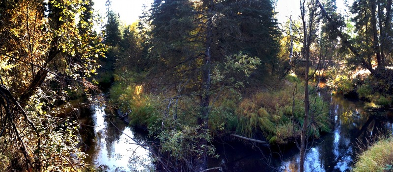
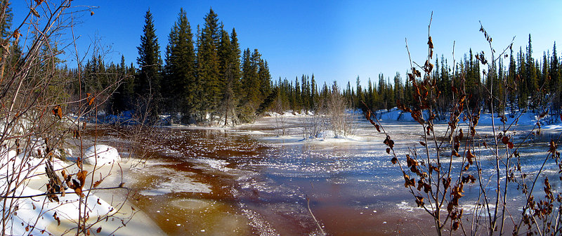
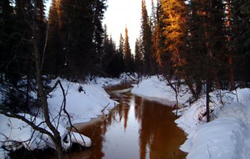
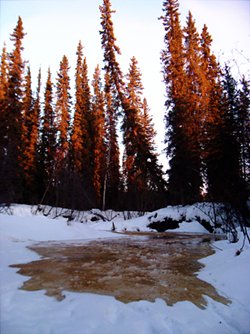
Another iPhone panorama, this time with the Pano app. I had been using AutoStitch, which makes panoramas from a series of existing photos. Pano takes a different approach: you shoot a series of photos, in order from left to right, from inside the app. After each image, the app asks if you’re happy with the shot, or if you’d like to retake it. If you’re happy with it, it stores it, and then shows you a semi-transparent slice of the right edge of the photo superimposed over the left side of the current camera viewscreen. This makes it fairly easy to line up each shot as you pan across your scene. When you’ve taken all the photos you want, the app joins the images together and saves it to the Camera Roll on the iPhone.
The upside to Pano is that it’s much easier to get well aligned images, as long as there’s enough contrast in the individual pictures to allow you to line them up as you’re shooting. The down side is that the only layout the app can handle is a single row of landscape or portrait shots. AutoStitch can join photos in any combination. The panorama at the bottom of my previous post (our back yard) was built from two rows of four photos (8 images total). The top row included a nicely exposed blue sky, and the bottom row was primarily the tussock–permafrost landscape of our backyard. Even though there are some obvious artifacts in the final image, it would be hard to get such a nice overall exposure with Pano and the iPhone camera.
Curious to find out how far up the overflow went, I rode my bike on the mushing trail upstream to Larry’s pond. It’s a quarter-mile bicycle ride, but is more like half a mile upstream from our house as the fish swim. As you can see from the panorama above, the overflow is upstream of this point. My foot broke through the ice while I was taking this photo and it was about 8 inches deep at the edge of the pond. The Creek is connected to the pond on the left side of the photo. If the blog sidebar is cutting into the photo, you may need to make your browser window wider. Click on the image for a very large (1400 pixels wide) version.
The photo was stitched together with the Hugin front end to panorama tools. The exposure of the right-most frame isn’t perfect, but that’s where the sun was, so I think it did an amazing job.
Water over ice
Yesterday afternoon while I was brewing beer (more on that later), I took Nika out for our usual walk. We go across the bridge, walk along the north side of the Creek until we get to the confluence of the Creek and the Slough (the “stick throwing spot”), then drop down onto the Creek and walk back. Typically we’ll walk under the bridge and come back up onto land near the red cabin. Yesterday we kept going another few hundred feet until we came across some overflow. It was only a few inches deep and didn’t seem to be advancing.
Last year we got some overflow early in the winter, but by January it seemed to have stopped and we didn’t get anymore until the Creek broke up at the end of April. This year it’s been lightly overflowing in spots around our house pretty much all winter. With all the late season snow, it’s been a good thing because it keeps the depth of the snow on the Creek lower than it would be. I did use snowshoes a couple times because the snow had gotten deep enough that it wasn’t fun to wade through, and Nika had a hard time swimming through it.
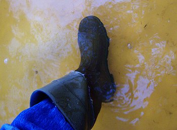
In the evening, I got up to get myself a Silver Gulch Hefeweizen, and was surprised to see running water over the whole length of the Creek. I went outside to investigate and take some photos. The water flowing over the ice was about 10 inches deep (you can see it in the photo of my boot on the right). The photo on the left (assuming you’re reading this on my blog and not in an aggregator…) shows what it looked like when I initially got out there.
I walked downstream through the overflow and came to the end of it near the stick throwing spot. It was pretty wild walking through almost a foot of water on top of the ice, and as I neared the bend at the slough, it started getting shallower and shallower. Eventually, I walked up onto the snow and took a few photos as the water advanced.
This morning the water level on top of the ice is up to 14 inches. The low temperature last night was -14°F (and it’s still -10°F as I type this), so the margins of the overflow are already frozen to around ½ an inch, and there’s steam rising from the flowing center. It’s great to hear flowing water again, but that much water suddenly appearing does make me a little nervous. We’re not in any present danger as the low point in the dog yard is easily three feet higher than the current level of the slough, but when a foot of water can suddenly appear over the frozen ice, who knows?
The top of the slough now has some water in it too, but I haven’t walked out on the trail to see how far the water has advanced. Depending on how much more water there is and the average temperature for the upcoming weeks, it looks like our walks on the Creek might be over for this winter. I’m curious to see how all the water will affect the breakup date this year. The weather service is predicting lows in the 20s and highs near 40 all week in Fairbanks, but that probably means lows near zero and highs barely above freezing here in the Valley, so breakup probably isn’t happening this week.
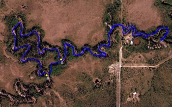
I just got back from walking Nika and Piper on the Creek. I’d looked at my GPS track from yesterday’s walk on the Creek and saw an obvious shortcut (from point A to B on the map) to cut off some distance. My objective was to take the Creek out to a section line (at points D and E—click on the image to see a full size version) that I also saw from the satellite imagery for the area, and wanted a way to make the route shorter. Yesterday’s walk was more than five miles, even though a raven could have covered the distance in a little over a half mile.
We walked down the Creek, came to the start of the shortcut at point A, walked overland through the forest to point B back on the Creek, and I immediately turned the wrong direction. I’d already walked about halfway back to point A before I realized I went the wrong way. Next time, turn left!
It is amazing how disorienting the Creek is, even with a GPS. Because it winds back and forth so much, even if you know where you’re going and can see it on the little map your GPS is showing you, it’s really difficult to tell if you are getting closer to your objective. The good thing is that the Creek only goes two ways. If you went the wrong way, just turn around and go back.
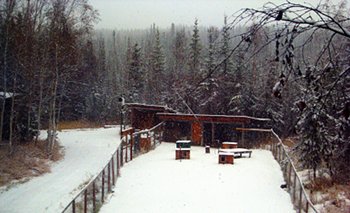
A week or so ago we got a weather station (it’s the thing at the top of the pole on the left side of the dog yard fence in the photo) so we can keep track of the weather at our house. We’re one of the coldest places in the Fairbanks area, so we’re excited to see just how different our weather is. We’re sending the data to the Citizen Weather Observer Program where it’s ingested, analyzed, and disseminated by NOAA. I don’t know if they use it in their forecasting, but we’ve already shown up in a few Public Information Statements from the local forecast office.
Full details on the station, with some plots and other data reports (I’m still working on most of these…) are at http://swingleydev.com/weather/dw1454/. The station code is DW1454 and shows up in MADIS as D1454.
